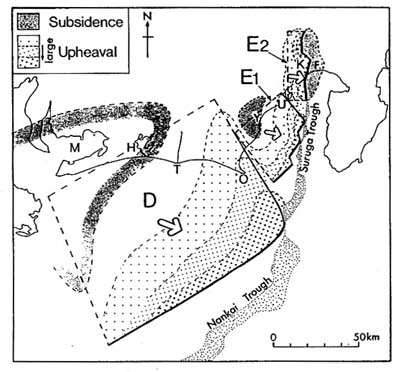
C. 80年代の陸域と海底の地形と地質構造から推定された臨層モデル (遠州灘,駿河湾南西部,同北部〜富士川河口断層帯の3つの断層を想定)
Fig.5. Proposed fault model of the Enshu-nada and Suruga Bay region and the vertical displacement pattern inferred from the structural unit division. M: Mikawa Bay, H: Hamana Lake, T: R.Tenryu, O: Omaezaki Y: Yaizu, U: Udo Hills, K: Kanbara Hills, F: Fuji.