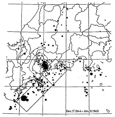
Fig. 9. Compilation of epicenter distribution crustal movement and a fault model of the Tonankai earthquake. All the hypocenters with focal depths less than 90km for the period from December 7, 1944 to January 31,1945 are in the plot. Crustal movement and fault model are after INOUCHI and SATO (1975).